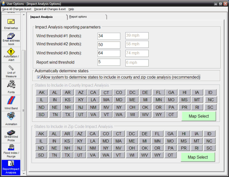
Enabling this option allows the system to determine the affected states rather than the user having to determine this for each storm / report. Enabling this option is highly recommended.
This option allows the user to set the wind ranges (knots) for the impact analysis report which is available after doing a county or zip code analysis report. The impact analysis report displays the total population and number of households that are forecasted to be affected by certain levels of wind. See the county or zip code analysis report for more information.
This option allows the user to set the wind threshold (knots) at which they want to see summary information on the location analysis summary report. Locations that are not forecast to reach this level of wind, will not appear on the summary report. If using the Advanced Wind Estimation capabilities of the system, it is recommended that this value be set a 5. In this way, locations that have maximum winds of less than 34 knots will still get reported. Setting this field to zero will force every location to appear in the summary wind analysis reports. It is not recommended that you do this for the county and zip code reports.
Use this option to specify which states you would like to include in the County Wind Profile Analysis report. If you have interest in only a few states then you can check only those states. This will improve the performance in generating the county wind report. You may also choose the MAP SELECT option which will let you choose states graphically.
Use this option to specify which states you would like to include in the Zip Code Wind Profile Analysis report. If you have interest in only a few states then you can check only those states. This will improve the performance in generating the report. You may also choose the MAP SELECT option which will let you choose states graphically.
Impact Analysis Preferences

Point and click on the user preference options shown above for a description of what they control.