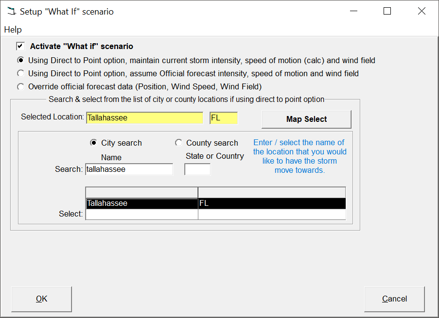
By selecting this option, the user is presented with a large map covering the entire tropical storm basin. By left clicking on a map location, and selecting accept, this location (Latitude and Longitude) will be the selected target point.
This option when selected will change the official forecast path of the current storm to a motion directly towards a location or allow the user to override the official forecast information (latitude, longitude, wind speed, wind radii).
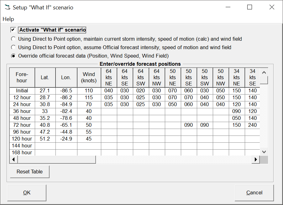
This is the area where the user can override the official forecast information for the "What if" forecast. The user can adjust the forecast positions, wind intensity, and areas of 64, 50 and 34 knot winds.
There are 3 options when selecting the "What if" tool.
- To maintain the storm's current intensity through 120 hours regardless of the official forecast intensity and wind field projections as well as ignoring landfall effects, etc..
- To utilize the official forecast intensity and wind field projections throughout the 120 hour forecast period. This method should only be used when the "What If" deviation from official forecast is relatively small and landfall times, etc. are similar to the official forecast track..
- To override the official forecast position, intensity and wind field projections. When this option is selected, the "Intensity and Wind Field" tab is enabled and the user can then override the forecast parameters.
This closes the current window saving the changed options.
This closes the current window WITHOUT saving the changed options.
"What If" Setup
Point and click on the options shown above for a description of what they control. For more information, see "What if capabilities".